
Cnoc a' Chomh-stri [Inverliever Hill]
Good walks are even better shared.
Overview
Cnoc a' Chomh-stri [Inverliever Hill]
Located in the breathtaking Scottish Highlands, Cnoc a' Chomh-stri stands proud at 537 meters. This Marilyn is not only a splendid hiking destination but also a place steeped in history and geological mystery. The name itself translates to 'Hill of the Confluence', hinting at the natural beauty that surrounds it as streams converge at its foothills.
Geology
The hill is primarily formed from metamorphic rocks, particularly schist, a testament to the immense geological forces at work millions of years ago. The smooth, rounded summit was sculpted by glaciers, leaving behind stunning features that any geology enthusiast would appreciate.
Routes
A popular route to the summit begins at the Inverliever Forest Trail. This trail is well-marked and leads you through enchanting woodlands, gradually revealing the majestic views that await at the top. The 7.5 km trek is rated as moderate, making it accessible for many. Allow about 3 hours to reach the summit, giving you plenty of time to enjoy the scenery and perhaps have a well-deserved snack!
Summit Features
Upon reaching the top, hikers will be greeted by a simple yet defining cairn and a trig point. These not only serve as perfect navigation aids but also as a backdrop for capturing the moment with friends and family. Don’t forget to strike a pose!
Views
Once at the summit, the breathtaking panorama offers views of nearby peaks and the sprawling landscape all the way to the coast. On clearer days, you might even spot the distant Isle of Islay, inviting you to ponder your next adventure. For the best photographic opportunities, consider visiting in the spring or autumn when the colours and clarity are at their finest.
Hazards
Whilst hiking this lovely hill, keep in mind that the weather can change rapidly. It’s best to check conditions before setting off. Some parts of the trail can be quite boggy, especially after rain, so sturdy boots are a life-saver! Nobody wants to give their friends a good laugh by landing knee-deep in a bog.
Access
Accessing Cnoc a' Chomh-stri is straightforward. The nearest car park is conveniently situated at the trailhead, with enough space for several vehicles. As for public transport, options are a bit sparse, so carpooling or planning ahead is advisable. Oban, about 25 km away, has all the necessary facilities, including places to grab a hearty meal post-hike.
Nearby Summits
Just a hop, skip, and a jump away are other summits like Ben More and Beinn Dubh, both offering further exploration opportunities for the enthusiastic hiker.
Facilities
While you won’t find amenities on the hill, Oban's vibrant town has plenty of cafes, shops, and toilets to cater to all your needs before or after your adventure.
Cnoc a' Chomh-stri is a perfect choice for those looking to experience the wild beauty of the Scottish Highlands, rich in both natural scenery and interesting history. Now lace up your boots and get ready for an unforgettable adventure!
Explore routes near Cnoc a' Chomh-stri [Inverliever Hill]
Public walks starting within 80 km of this hill. Nearby does not mean a route reaches the summit; check its map and access before setting out.
Crinan Canal: Bellanoch and Dunardry towpath return
View route
Glen Kin group walk
View route
Beinn Ime from Succoth
View route
The Cobbler from Succoth Carpark
View route
Route planning notes
These notes describe possible approaches, not verified navigable routes or permission to cross land. Check current paths, local access rules and conditions before setting out.
Inverliever Forest Trail
A well-marked trail starting from Inverliever Forest, winding through lush woodlands before ascending to the summit.
Make a day of it, together
Find someone to share the walk with, or organise a day out along a route you like.
Hill facts and local notes
Classifications
Elevation
346m
1,135 ft
Prominence
107m
Coordinates
56.2366, -5.3486
NM925099
OS Map
55
Explorer: 360S
At the Summit
The summit features a modest cairn and a trig point, providing excellent points of reference for both navigation and the obligatory summit selfie.
Terrain & Geology
Cnoc a' Chomh-stri is primarily composed of metamorphic rocks, predominantly schist, which have been shaped by glacial activity creating its smooth, rounded summit. The area has a rich geological history dating back over 400 million years.
Views & Scenery
From the summit, enjoy panoramic views of the surrounding mountains, the expansive landscape down to the coast, and on a clear day, you might catch a glimpse of the Isle of Islay in the distance.
History & Heritage
Name Origin
The name 'Cnoc a' Chomh-stri' translates to 'Hill of the Confluence', reflecting its location near where several small streams meet.
Historical Significance
This hill has been part of local culture and folklore, often associated with stories of ancient clans and historic battles.
Getting There & Facilities
Check current local access restrictions, parking rules and transport timetables before travelling. These notes do not confirm public access to the summit.
Parking
There is a small car park at the start of the Inverliever Forest trail, which can accommodate several vehicles. Look out for the little wooden sign indicating the trailhead.
Public Transport
Public transport options are limited; however, local bus services from nearby towns may occasionally operate. It's best to check local schedules or consider carpooling.
Nearby Facilities
While there are no facilities directly on the hill, the nearby town of Oban has restaurants, shops, and public toilets.
Safety Information
Known Hazards
- Be aware of changing weather conditions which can lead to poor visibility. Some parts of the trail can be boggy, so keep an eye on your footing to avoid unexpected splashes!
General Safety Tips
- Check weather conditions before setting out
- Carry appropriate clothing and equipment
- Let someone know your planned route
- Take a map, compass, and GPS device
- Carry emergency supplies: food, water, first aid kit, torch
Hills
Some common questions about the hills answered
Are there group walks up Cnoc a' Chomh-stri [Inverliever Hill]?
Many walkers use Walkmates to join or organise walks with others. You can check for group walks around Cnoc a' Chomh-stri [Inverliever Hill] through the maps
Are there other walkers around Cnoc a' Chomh-stri [Inverliever Hill]?
Activity varies by location and time, but Walkmates lets you see whether others have shared walks or shown interest in this area. Find other people through the walking friends search walking friends for Cnoc a' Chomh-stri [Inverliever Hill] search or of course create your own walk for Cnoc a' Chomh-stri [Inverliever Hill]
Can I organise a walk to Cnoc a' Chomh-stri [Inverliever Hill]?
Yes. If there aren’t any walks listed already, you can create a walk and make it available for others to join.
If you're signed up to Walkmates, you can create a walk to Cnoc a' Chomh-stri [Inverliever Hill].
How do I find a walk up this hill?
There are often multiple ways to walk this hill, depending on experience and route preference. Walkmates helps you explore walks and routes that others have shared.
Can I suggest a new route up Cnoc a' Chomh-stri [Inverliever Hill]?
Yes. You can suggest or create routes to share with others. Walkmates focuses on the social side of walking, so routes are used to help people organise walks and explore areas together, rather than as detailed navigation tools or route libraries.
Other uses really appreciate knowledgeable walkers sharing their routes. Share your favourite route to Cnoc a' Chomh-stri [Inverliever Hill] here
The is an error or something incorrect about this hill. How do I let you know?
We always strive to keep the information on Walkmates as accurate as possible. If you find an error, please let us know through the contact form and we'll aim to correct it as quickly as possible
Community Discussion
Comments
Location
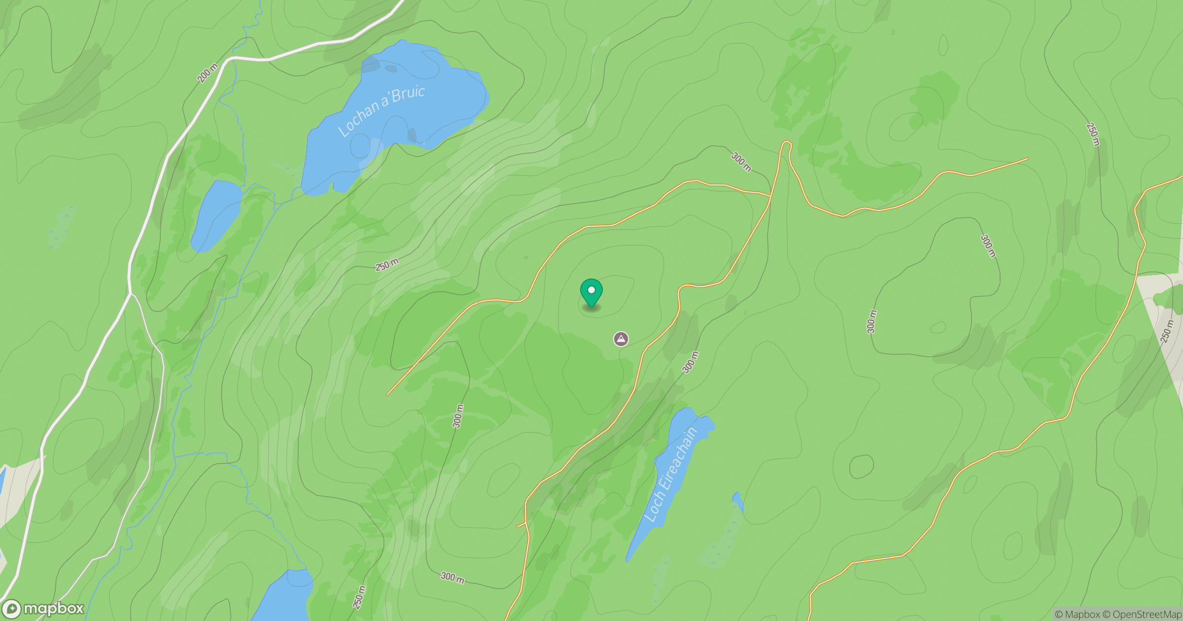
Grid reference: NM925099
View on OpenStreetMapOpens a map in a new tab, centred on the hill.
Hills within 30 km
Straight-line distance, not a walking route or confirmation of access.
No comments yet. Be the first.